
Thank you for supporting this site ❤️
Make a donation
Make a donation
Villa Borghese Park topographic map
Click on the map to display elevation.
Thank you for supporting this site ❤️
Make a donation
Make a donation
About this map
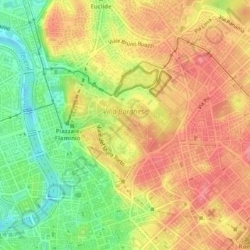
Name: Villa Borghese Park topographic map, elevation, terrain.
Location: Villa Borghese Park, Rome, Roma Capitale, Lazio, Italy (41.90609 12.47393 41.91970 12.49401)
Average elevation: 52 m
Minimum elevation: 7 m
Maximum elevation: 85 m
Thank you for supporting this site ❤️
Make a donation
Make a donation
Other topographic maps
Click on a map to view its topography, its elevation and its terrain.