
Thank you for supporting this site ❤️
Make a donation
Make a donation
Dyserth topographic map
Click on the map to display elevation.
Thank you for supporting this site ❤️
Make a donation
Make a donation
About this map
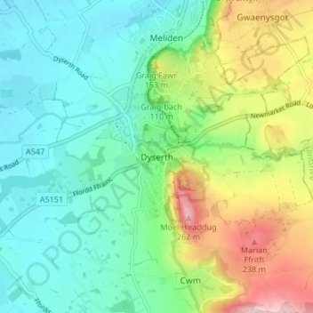
Name: Dyserth topographic map, elevation, terrain.
Location: Dyserth, Denbighshire, Wales, LL18 6AA, United Kingdom (53.28048 -3.43305 53.32048 -3.39305)
Average elevation: 90 m
Minimum elevation: 9 m
Maximum elevation: 276 m
Thank you for supporting this site ❤️
Make a donation
Make a donation