
Thank you for supporting this site ❤️
Make a donation
Make a donation
汉石 topographic map
Click on the map to display elevation.
Thank you for supporting this site ❤️
Make a donation
Make a donation
About this map
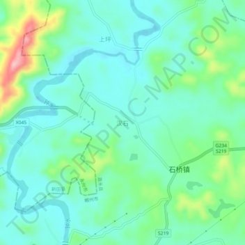
Name: 汉石 topographic map, elevation, terrain.
Location: 汉石, 郴州市, 湖南省, 中国 (25.72473 112.37209 25.76473 112.41209)
Average elevation: 190 m
Minimum elevation: 148 m
Maximum elevation: 318 m
Thank you for supporting this site ❤️
Make a donation
Make a donation
Other topographic maps
Click on a map to view its topography, its elevation and its terrain.
Thank you for supporting this site ❤️
Make a donation
Make a donation
Thank you for supporting this site ❤️
Make a donation
Make a donation