
Lake Neusiedl topographic map
Interactive map
Click on the map to display elevation.
About this map
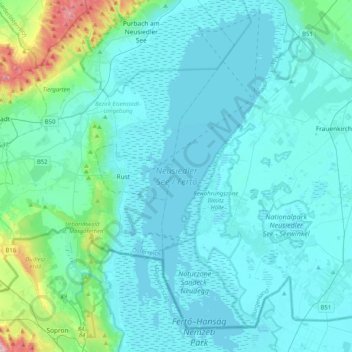
Name: Lake Neusiedl topographic map, elevation, terrain.
Location: Lake Neusiedl, Ruster Bucht, Rust, Burgenland, 7071, Austria (47.66319 16.68682 47.93789 16.86297)
Average elevation: 147 m
Minimum elevation: 109 m
Maximum elevation: 470 m