
Lievegem topographic map
Interactive map
Click on the map to display elevation.
About this map
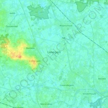
Name: Lievegem topographic map, elevation, terrain.
Location: Lievegem, Gent, East Flanders, Belgium (51.07414 3.50965 51.17538 3.66701)
Average elevation: 7 m
Minimum elevation: 2 m
Maximum elevation: 28 m