
Cayponce topographic map
Click on the map to display elevation.
About this map
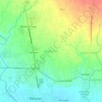
Name: Cayponce topographic map, elevation, terrain.
Location: Cayponce, Balayan, Batangas, Calabarzon, 4213, Philippines (13.93678 120.71576 13.97678 120.75576)
Average elevation: 30 m
Minimum elevation: 4 m
Maximum elevation: 71 m
Other topographic maps
Click on a map to view its topography, its elevation and its terrain.