
Thank you for supporting this site ❤️
Make a donation
Make a donation
Perm District topographic map
Click on the map to display elevation.
Thank you for supporting this site ❤️
Make a donation
Make a donation
About this map
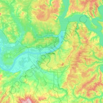
Name: Perm District topographic map, elevation, terrain.
Location: Perm District, Perm Krai, Volga Federal District, Russia (57.86790 55.79892 58.17715 56.65664)
Average elevation: 153 m
Minimum elevation: 83 m
Maximum elevation: 349 m
Thank you for supporting this site ❤️
Make a donation
Make a donation
Other topographic maps
Click on a map to view its topography, its elevation and its terrain.