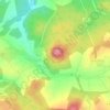
Dockweiler topographic map
Click on the map to display elevation.
Dockweiler
The municipality lies on the watershed between the Ahr and the Moselle in the heart of the Vulkaneifel, a part of the Eifel known for its volcanic history, geographical and geological features, and even ongoing activity today, including gases that sometimes well up from the earth. Dockweiler lies in the north of Rhineland-Palatinate at an elevation of roughly 500 to 560 m above sea level between Daun and Gerolstein.
About this map

Name: Dockweiler topographic map, elevation, terrain.
Average elevation: 558 m
Minimum elevation: 458 m
Maximum elevation: 696 m
Other topographic maps
Click on a map to view its topography, its elevation and its terrain.
Hinterhausen
Germany > Rhineland-Palatinate > Landkreis Vulkaneifel > Gerolstein
Average elevation: 455 m