
Thank you for supporting this site ❤️
Make a donation
Make a donation
North Burnett Regional topographic map
Click on the map to display elevation.
Thank you for supporting this site ❤️
Make a donation
Make a donation
About this map
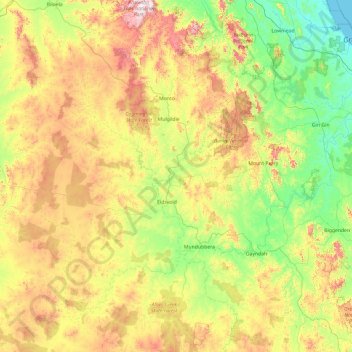
Name: North Burnett Regional topographic map, elevation, terrain.
Location: North Burnett Regional, Queensland, Australia (-26.09668 150.36965 -24.39208 152.27636)
Average elevation: 277 m
Minimum elevation: -1 m
Maximum elevation: 915 m
Thank you for supporting this site ❤️
Make a donation
Make a donation
Other topographic maps
Click on a map to view its topography, its elevation and its terrain.
Thank you for supporting this site ❤️
Make a donation
Make a donation
Thank you for supporting this site ❤️
Make a donation
Make a donation