
Uttlesford topographic map
Interactive map
Click on the map to display elevation.
About this map
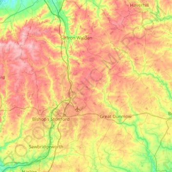
Name: Uttlesford topographic map, elevation, terrain.
Location: Uttlesford, Essex, England, United Kingdom (51.76731 0.06810 52.09266 0.51925)
Average elevation: 85 m
Minimum elevation: 20 m
Maximum elevation: 152 m