
Thank you for supporting this site ❤️
Make a donation
Make a donation
Buchberg topographic map
Click on the map to display elevation.
Thank you for supporting this site ❤️
Make a donation
Make a donation
About this map
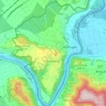
Name: Buchberg topographic map, elevation, terrain.
Location: Buchberg, Schaffhausen, 8454, Switzerland (47.55237 8.53355 47.60006 8.59427)
Average elevation: 429 m
Minimum elevation: 339 m
Maximum elevation: 677 m
Thank you for supporting this site ❤️
Make a donation
Make a donation