
Thank you for supporting this site ❤️
Make a donation
Make a donation
1st district topographic map
Click on the map to display elevation.
Thank you for supporting this site ❤️
Make a donation
Make a donation
About this map
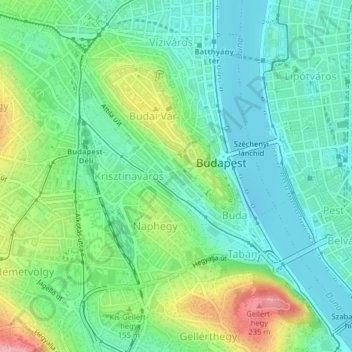
Name: 1st district topographic map, elevation, terrain.
Location: 1st district, Budapest, Central Hungary, Hungary (47.48567 19.02376 47.50807 19.05131)
Average elevation: 137 m
Minimum elevation: 97 m
Maximum elevation: 228 m
Thank you for supporting this site ❤️
Make a donation
Make a donation