
Thank you for supporting this site ❤️
Make a donation
Make a donation
Làconi/Laconi topographic map
Click on the map to display elevation.
Thank you for supporting this site ❤️
Make a donation
Make a donation
About this map
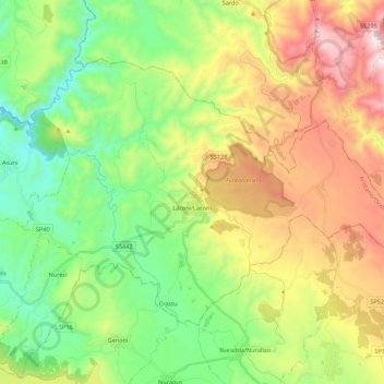
Name: Làconi/Laconi topographic map, elevation, terrain.
Location: Làconi/Laconi, Aristanis/Oristano, Sardinia, 08034, Italy (39.80088 8.95388 39.91811 9.17294)
Average elevation: 514 m
Minimum elevation: 113 m
Maximum elevation: 1,172 m
Thank you for supporting this site ❤️
Make a donation
Make a donation
Other topographic maps
Click on a map to view its topography, its elevation and its terrain.
Thank you for supporting this site ❤️
Make a donation
Make a donation
Thank you for supporting this site ❤️
Make a donation
Make a donation
Torre Grande
Italy > Sardinia > Aristanis/Oristano > Aristanis/Oristano > Torregrande
Average elevation: 1 m
Thank you for supporting this site ❤️
Make a donation
Make a donation