
Indaiatuba topographic map
Click on the map to display elevation.
Indaiatuba
Indaiatuba is a municipality in the state of São Paulo in Brazil. It is part of the Metropolitan Region of Campinas. The population is 256,223 (2020 est.) in an area of 311.5 km2 (120.3 sq mi). The elevation is 624 m (2,047 ft). The city's name derives from the Tupi language. It is an important city in one of Brazil's main industrial regions.
About this map
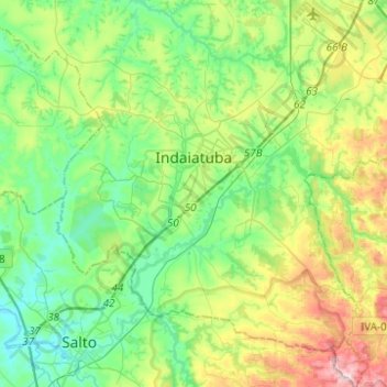
Name: Indaiatuba topographic map, elevation, terrain.
Average elevation: 619 m
Minimum elevation: 497 m
Maximum elevation: 916 m
Other topographic maps
Click on a map to view its topography, its elevation and its terrain.