
Thank you for supporting this site ❤️
Make a donation
Make a donation
Bouaflé topographic map
Click on the map to display elevation.
Thank you for supporting this site ❤️
Make a donation
Make a donation
About this map
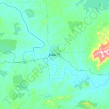
Name: Bouaflé topographic map, elevation, terrain.
Location: Bouaflé, Marahoué, Sassandra-Marahoué, Côte d’Ivoire (6.82018 -5.90583 7.14018 -5.58583)
Average elevation: 206 m
Minimum elevation: 151 m
Maximum elevation: 601 m
Thank you for supporting this site ❤️
Make a donation
Make a donation
Other topographic maps
Click on a map to view its topography, its elevation and its terrain.