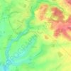
Click on the map to display elevation.
Name: Surin topographic map, elevation, terrain.
Location: Surin, Parthenay, Deux-Sèvres, Nouvelle-Aquitaine, Metropolitan France, 79220, France (46.42443 -0.48504 46.50669 -0.43849)
Average elevation: 91 m
Minimum elevation: 31 m
Maximum elevation: 143 m
Click on a map to view its topography, its elevation and its terrain.
France > Nouvelle-Aquitaine > Deux-Sèvres > Melle
Average elevation: 134 m
France > Nouvelle-Aquitaine > Deux-Sèvres > La Crèche
Average elevation: 64 m
France > Nouvelle-Aquitaine > Deux-Sèvres > Celles-sur-Belle
Average elevation: 114 m
France > Nouvelle-Aquitaine > Deux-Sèvres > Asnières-en-Poitou
Average elevation: 68 m
France > Nouvelle-Aquitaine > Deux-Sèvres > Avon
Average elevation: 139 m
France > Nouvelle-Aquitaine > Deux-Sèvres > Gourgé