
Thank you for supporting this site ❤️
Make a donation
Make a donation
Bayfield County topographic map
Click on the map to display elevation.
Thank you for supporting this site ❤️
Make a donation
Make a donation
About this map
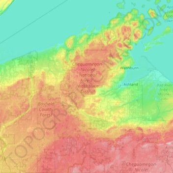
Name: Bayfield County topographic map, elevation, terrain.
Location: Bayfield County, Wisconsin, United States (46.15460 -91.55357 47.00346 -90.75058)
Average elevation: 295 m
Minimum elevation: 173 m
Maximum elevation: 566 m
Thank you for supporting this site ❤️
Make a donation
Make a donation
Other topographic maps
Click on a map to view its topography, its elevation and its terrain.
Thank you for supporting this site ❤️
Make a donation
Make a donation
Thank you for supporting this site ❤️
Make a donation
Make a donation