
Thank you for supporting this site ❤️
Make a donation
Make a donation
Tahlequah topographic map
Click on the map to display elevation.
Thank you for supporting this site ❤️
Make a donation
Make a donation
About this map
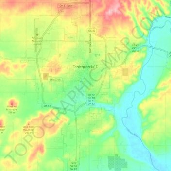
Name: Tahlequah topographic map, elevation, terrain.
Location: Tahlequah, Cherokee County, Oklahoma, United States (35.85634 -95.01517 35.95279 -94.94190)
Average elevation: 256 m
Minimum elevation: 198 m
Maximum elevation: 341 m
Thank you for supporting this site ❤️
Make a donation
Make a donation