
Thank you for supporting this site ❤️
Make a donation
Make a donation
Osiglia topographic map
Click on the map to display elevation.
Thank you for supporting this site ❤️
Make a donation
Make a donation
About this map
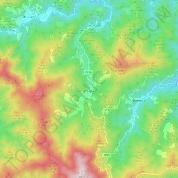
Name: Osiglia topographic map, elevation, terrain.
Location: Osiglia, Savona, Liguria, Italy (44.24249 8.15617 44.32429 8.23437)
Average elevation: 809 m
Minimum elevation: 466 m
Maximum elevation: 1,377 m
Thank you for supporting this site ❤️
Make a donation
Make a donation
Other topographic maps
Click on a map to view its topography, its elevation and its terrain.