
Harpenden topographic map
Click on the map to display elevation.
About this map
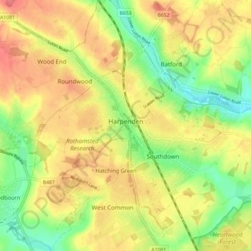
Name: Harpenden topographic map, elevation, terrain.
Location: Harpenden, St Albans, Hertfordshire, England, United Kingdom (51.78725 -0.38813 51.83988 -0.31936)
Average elevation: 119 m
Minimum elevation: 82 m
Maximum elevation: 151 m
Other topographic maps
Click on a map to view its topography, its elevation and its terrain.