
Thank you for supporting this site ❤️
Make a donation
Make a donation
Cagayan topographic map
Click on the map to display elevation.
Thank you for supporting this site ❤️
Make a donation
Make a donation
About this map
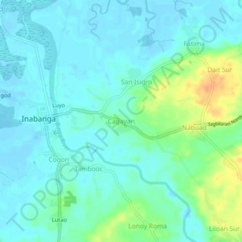
Name: Cagayan topographic map, elevation, terrain.
Location: Cagayan, Inabanga, Bohol, Central Visayas, Philippines (10.01048 124.05954 10.05048 124.09954)
Average elevation: 9 m
Minimum elevation: -5 m
Maximum elevation: 37 m
Thank you for supporting this site ❤️
Make a donation
Make a donation