
León topographic map
Click on the map to display elevation.
About this map
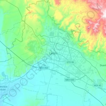
Name: León topographic map, elevation, terrain.
Location: León, Guanajuato, 37370, Mexico (20.96197 -101.84298 21.28197 -101.52298)
Average elevation: 1,946 m
Minimum elevation: 1,748 m
Maximum elevation: 2,850 m