
Thank you for supporting this site ❤️
Make a donation
Make a donation
Wahiawa topographic map
Click on the map to display elevation.
Thank you for supporting this site ❤️
Make a donation
Make a donation
About this map
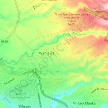
Name: Wahiawa topographic map, elevation, terrain.
Location: Wahiawa, Honolulu County, Hawaii, 96786, United States (21.48870 -158.05185 21.51243 -157.98614)
Average elevation: 292 m
Minimum elevation: 195 m
Maximum elevation: 424 m
Thank you for supporting this site ❤️
Make a donation
Make a donation
Other topographic maps
Click on a map to view its topography, its elevation and its terrain.