
Rioja topographic map
Interactive map
Click on the map to display elevation.
About this map
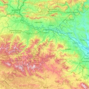
Name: Rioja topographic map, elevation, terrain.
Location: Rioja, Spain (41.91903 -3.13427 42.64426 -1.67870)
Average elevation: 879 m
Minimum elevation: 270 m
Maximum elevation: 2,297 m
Other topographic maps
Click on a map to view its topography, its elevation and its terrain.
Vega Larga
Spain > Rioja > Villavelayo
Vega Larga, Villavelayo, Rioja, Spain
Average elevation: 1,262 m