
Thank you for supporting this site ❤️
Make a donation
Make a donation
Puerto Asís topographic map
Click on the map to display elevation.
Thank you for supporting this site ❤️
Make a donation
Make a donation
About this map
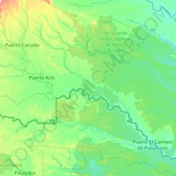
Name: Puerto Asís topographic map, elevation, terrain.
Location: Puerto Asís, Putumayo, RAP Amazonía, Colombia (0.21866 -76.77231 0.65992 -75.77270)
Average elevation: 312 m
Minimum elevation: 203 m
Maximum elevation: 2,480 m
Thank you for supporting this site ❤️
Make a donation
Make a donation
Other topographic maps
Click on a map to view its topography, its elevation and its terrain.