Cidade Ocidental topographic map
Click on the map to display elevation.
Cidade Ocidental
The municipality has a tropical with altitude climate with temperature variations between 18 °C and 28 °C. The vegetation is typical of the cerrado with short and twisted trees, with some pockets of tropical tree growth. The main rivers are the São Bartolomeu, Saia Velha and Mesquita.
About this map
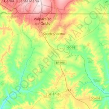
Name: Cidade Ocidental topographic map, elevation, terrain.
Location: Cidade Ocidental, Goiás, Central-West Region, Brazil (-16.25718 -47.96409 -16.04993 -47.67587)
Average elevation: 959 m
Minimum elevation: 790 m
Maximum elevation: 1,249 m
Other topographic maps
Click on a map to view its topography, its elevation and its terrain.



Rosa
Brazil > Goiás > Região Integrada de Desenvolvimento do Distrito Federal e Entorno > Pirenópolis
Average elevation: 780 m


Bom Jesus
Brazil > Goiás > Região Integrada de Desenvolvimento do Distrito Federal e Entorno > Pirenópolis
Average elevation: 760 m