

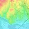
Cournonterral topographic map
Click on the map to display elevation.
About this map

Name: Cournonterral topographic map, elevation, terrain.
Average elevation: 99 m
Minimum elevation: 23 m
Maximum elevation: 315 m
Other topographic maps
Click on a map to view its topography, its elevation and its terrain.



Extension 19e s. de l'aqueduc Saint-Clément
France > Occitania > Hérault > Saint-Clément-de-Rivière
Average elevation: 87 m
