
Thank you for supporting this site ❤️
Make a donation
Make a donation
Westgrove topographic map
Click on the map to display elevation.
Thank you for supporting this site ❤️
Make a donation
Make a donation
About this map
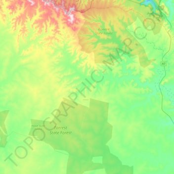
Name: Westgrove topographic map, elevation, terrain.
Location: Westgrove, Maranoa Regional, Queensland, Australia (-25.61089 148.33588 -25.22910 148.57147)
Average elevation: 540 m
Minimum elevation: 377 m
Maximum elevation: 908 m
Thank you for supporting this site ❤️
Make a donation
Make a donation
Other topographic maps
Click on a map to view its topography, its elevation and its terrain.
Thank you for supporting this site ❤️
Make a donation
Make a donation
Thank you for supporting this site ❤️
Make a donation
Make a donation