
Thank you for supporting this site ❤️
Make a donation
Make a donation
Oregon topographic map
Click on the map to display elevation.
Thank you for supporting this site ❤️
Make a donation
Make a donation
About this map
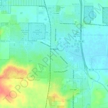
Name: Oregon topographic map, elevation, terrain.
Location: Oregon, Dane County, Wisconsin, 53575, United States (42.90465 -89.42327 42.94306 -89.36512)
Average elevation: 298 m
Minimum elevation: 281 m
Maximum elevation: 344 m
Thank you for supporting this site ❤️
Make a donation
Make a donation