
Make a donation
Pico Cristóbal Colón topographic map
Click on the map to display elevation.
Make a donation
Pico Cristóbal Colón
Pico Cristóbal Colón is possibly the highest mountain in Colombia, with a reported height of 5,775 metres (18,947 ft). Pico Cristóbal Colón and Pico Simón Bolívar are the two highest peaks in Colombia and almost equal in elevation. One of the two mountains is therefore the fifth most prominent in the world (see list of peaks by prominence). The nearest peak that is higher is Cayambe, some 1,288 kilometres (800 mi) away. There is a permanent snowcap on this peak and on the nearby mountains. It is part of the Sierra Nevada de Santa Marta range, along with Pico Simón Bolívar, and was named after Christopher Columbus. This mountain is the highest point in South America outside the Andes.
Make a donation
About this map
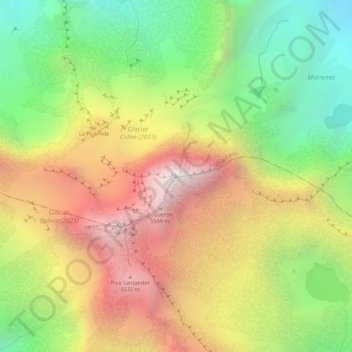
Name: Pico Cristóbal Colón topographic map, elevation, terrain.
Average elevation: 5,111 m
Minimum elevation: 4,516 m
Maximum elevation: 5,694 m
Make a donation
Other topographic maps
Click on a map to view its topography, its elevation and its terrain.