
Fern Tree topographic map
Click on the map to display elevation.
About this map
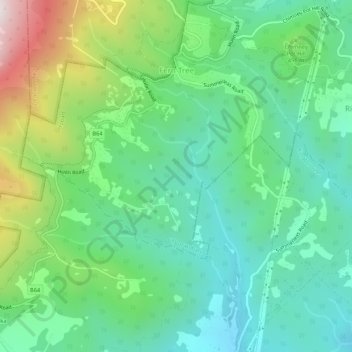
Name: Fern Tree topographic map, elevation, terrain.
Location: Fern Tree, Hobart, City of Hobart, Tasmania, Australia (-42.95345 147.23673 -42.91458 147.28991)
Average elevation: 404 m
Minimum elevation: 111 m
Maximum elevation: 1,114 m