
Thank you for supporting this site ❤️
Make a donation
Make a donation
Emigration Canyon topographic map
Click on the map to display elevation.
Thank you for supporting this site ❤️
Make a donation
Make a donation
About this map
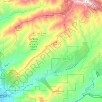
Name: Emigration Canyon topographic map, elevation, terrain.
Location: Emigration Canyon, Salt Lake County, Utah, United States (40.74523 -111.80999 40.83534 -111.68920)
Average elevation: 1,983 m
Minimum elevation: 1,477 m
Maximum elevation: 2,728 m
Thank you for supporting this site ❤️
Make a donation
Make a donation
Other topographic maps
Click on a map to view its topography, its elevation and its terrain.